Here’s when Ottawa could see 10-15 cm of ‘significant’ snow and rain this week
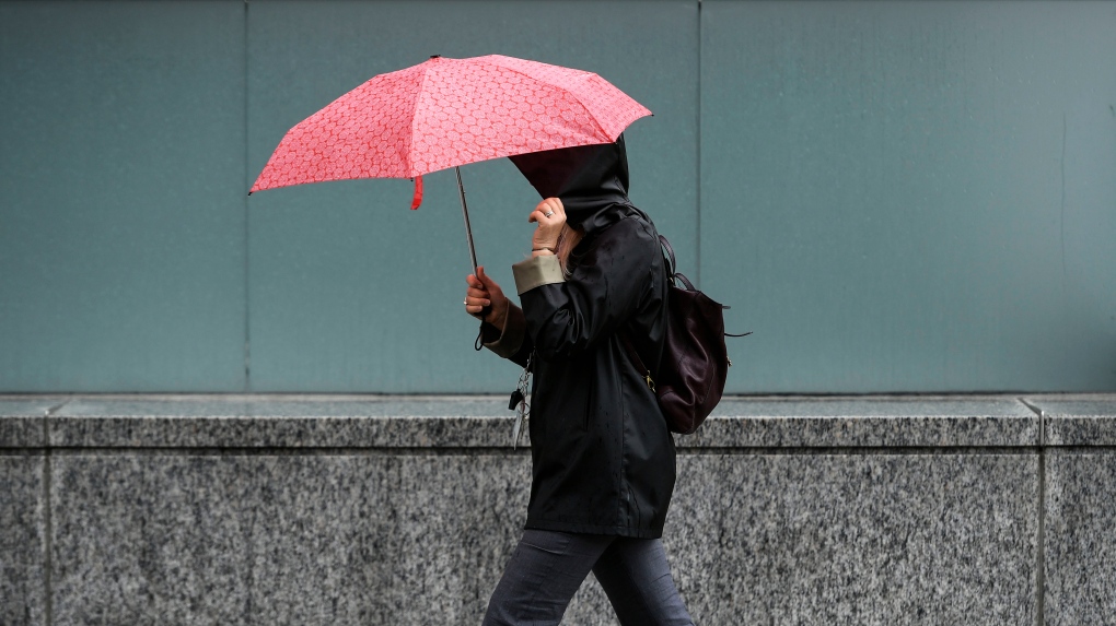
Ottawa could see 10 to 15 cm of “significant” snow, rain and strong winds over the next few days, as a spring storm blows through eastern Ontario this week.
Environment Canada has issued a special weather statement for Ottawa, warning of heavy precipitation on Wednesday and Thursday.
“A Colorado low is expected to begin affecting the region Wednesday morning. Precipitation is expected to begin as rain transitioning to snow late Wednesday afternoon or early evening,” the weather agency said in a statement.
“Snow, which may be heavy at times, is expected to continue through Wednesday night easing Thursday night. Significant snowfall accumulations are possible by the time snow begins to ease Thursday night.”
Environment Canada’s forecast calls for Ottawa to see 10 to 15 mm of rain on Wednesday, followed by 10 to 15 cm of snow Wednesday night and Thursday.
The record for greatest rainfall on April 3 in Ottawa is 18.6 mm, set back in 1990. The record for greatest snowfall on April 3 in Ottawa is 26.7 cm, set in 1975. The record for April 4 is 9.2 cm, established in 2004.
Environment Canada does warn the storm conditions may change leading up to its arrival.
“Confidence is low as there remains a high degree of uncertainty with the low’s track, which will have significant impacts on temperatures, snowfall amounts as well as when rain will transition to snow,” Environment Canada says.
“Warnings, if required, will be issued as the event draws nearer.”
Environment Canada senior meteorologist David Phillips says meteorologists are keeping an eye on the track of the storm.
“It’s a massive system, sort of reformed as a Colorado low, and it’s coming to us,” Phillips told Newstalk 580 CFRA’s the Morning Rush with Bill Carroll on Tuesday.
“It’s drawing in some cold air from the north, and that’s the issue is that we’re not certain exactly how close that storm system is going to come into Ontario.”
Phillips says the temperature will determine whether Ottawa sees snow or rain.
“The temperatures are going to hover around the freezing mark, and that’s really the magic point of whether you’re going to get the snow or the rain.”
The snow comes after Ottawa only received 5.2 cm of snow in March. A report from Environment Canada says the 5.2 cm of snow in March was 14 per cent of the normal snowfall Ottawa sees in the month (38.3 cm).
Ottawa weather
Here is a look at the forecast for Ottawa over the next few days.
Sunny today. High 12 C.
Cloudy tonight with a 30 per cent chance of showers. Rain beginning before morning. Low 5 C.
30 per cent chance of rain mixed with snow beginning in the morning. Rainfall amount 10-20 mm. High 6 C.
Rain mixed with snow Wednesday night. Snowfall 10-15 cm. Low -1 C.
Thursday will see snow. High 1 C.
The outlook for Friday calls for cloudy with a chance of flurries or showers. High 4 C.
Saturday will see a mix of sun and cloud with a chance of flurries or showers. High 9 C.
View original article here Source

Apple Watch SE (2nd Gen) (GPS + Cellular 44mm) Midnight Aluminium Case with Midnight Sport Band, Regular (Renewed)
$253.09 (as of April 13, 2024 08:31 GMT -05:00 - More infoProduct prices and availability are accurate as of the date/time indicated and are subject to change. Any price and availability information displayed on [relevant Amazon Site(s), as applicable] at the time of purchase will apply to the purchase of this product.)
McCafe Premium Medium Dark Roast K-Cup Coffee Pods, 48 Count, For Keurig Coffee Makers
$31.56 (as of April 13, 2024 08:31 GMT -05:00 - More infoProduct prices and availability are accurate as of the date/time indicated and are subject to change. Any price and availability information displayed on [relevant Amazon Site(s), as applicable] at the time of purchase will apply to the purchase of this product.)
Apple AirPods 2 with Charging Case - White (Renewed)
$114.68 (as of April 13, 2024 08:31 GMT -05:00 - More infoProduct prices and availability are accurate as of the date/time indicated and are subject to change. Any price and availability information displayed on [relevant Amazon Site(s), as applicable] at the time of purchase will apply to the purchase of this product.)
Under Eye Mask - Reduce Dark Circles, Puffy Eyes, Undereye Bags, Wrinkles - Gel Under Eye Patches, Vegan Cruelty-Free Self Care by grace and stella (24 Pairs, Gold)
$27.95 (as of April 13, 2024 08:31 GMT -05:00 - More infoProduct prices and availability are accurate as of the date/time indicated and are subject to change. Any price and availability information displayed on [relevant Amazon Site(s), as applicable] at the time of purchase will apply to the purchase of this product.)
e.l.f. Squeeze Me Lip Balm, Moisturizing Lip Balm For A Sheer Tint Of Colour, Infused With Hyaluronic Acid, Vegan & Cruelty-free, Strawberry
$4.97 (as of April 13, 2024 08:31 GMT -05:00 - More infoProduct prices and availability are accurate as of the date/time indicated and are subject to change. Any price and availability information displayed on [relevant Amazon Site(s), as applicable] at the time of purchase will apply to the purchase of this product.)
WALNEW RFID Blocking Passport Holder Travel Wallet Cover Case
$11.99 (as of April 13, 2024 08:31 GMT -05:00 - More infoProduct prices and availability are accurate as of the date/time indicated and are subject to change. Any price and availability information displayed on [relevant Amazon Site(s), as applicable] at the time of purchase will apply to the purchase of this product.)
Traditional Medicinals Organic Spearmint Herbal Tea, 16 Bags (Pack of 1)
$4.99 (as of April 13, 2024 08:31 GMT -05:00 - More infoProduct prices and availability are accurate as of the date/time indicated and are subject to change. Any price and availability information displayed on [relevant Amazon Site(s), as applicable] at the time of purchase will apply to the purchase of this product.)
Royale Velour Toilet Paper, 12 Equal 24 Rolls, 142 Bathroom Tissues per roll
$8.97 (as of April 13, 2024 08:31 GMT -05:00 - More infoProduct prices and availability are accurate as of the date/time indicated and are subject to change. Any price and availability information displayed on [relevant Amazon Site(s), as applicable] at the time of purchase will apply to the purchase of this product.)
Zulay Powerful Milk Frother Handheld Foam Maker for Lattes - Whisk Drink Mixer for Coffee, Mini Foamer for Cappuccino, Frappe, Matcha, Hot Chocolate by Milk Boss (Black)
$13.39 (as of April 13, 2024 08:31 GMT -05:00 - More infoProduct prices and availability are accurate as of the date/time indicated and are subject to change. Any price and availability information displayed on [relevant Amazon Site(s), as applicable] at the time of purchase will apply to the purchase of this product.)