Josh Classen’s forecast: The heat wave is here…and it’s staying for at least a week
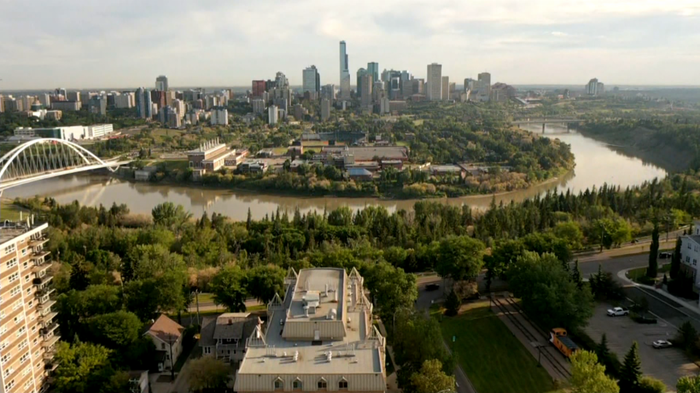
A heat warning is in effect for Edmonton and almost all of Alberta.
Temperatures in most areas will reach the low 30s for afternoon highs through to at least the end of the coming weekend.
Morning lows will be in the 15 to 20 degree range.
For Edmonton, the morning lows will likely be even warmer. We’ll probably get lows in the 18 to 22 degree range!
So, it’s not just the daytime heat that’ll be an issue with this heat wave. We’re not going to get any relief overnight/morning AND it will end up being one of, if not THE, longest-duration heat waves on record.
We’ll go seven or eight consecutive days above 30 degrees. There will likely be some daily record highs that get set, but the duration could be a record-setter too.
Here are the longest stretches of consecutive days above 30.0 degrees in Edmonton:
- 2021 – 7 days
- 1961 – 6 days
- 1941 – 5 days
*10 other years have had 4-day stretches
At the very least…we’ll tie that record of 7 days.
If we get to 30 today, we’ll be on pace for a record-setting 8 consecutive days above 30 degrees.
As for today – the Upper Ridge hasn’t fully moved in yet to cap things off and give us the blue skies to go along with the heat.
(That’ll start Wednesday)
We have some showers and thunderstorms in central and north-central Alberta this morning and we may see some of that action in and around the city later this morning/midday.
There’s also a chance of a supper-time shower or thunderstorm developing over or near Edmonton.
Best bet for late-day storms will be in the foothills.
Wildfire smoke continues to be an issue in northern AB (particularly in the NE).
The latest modelling continues to keep that smoke out of the Edmonton area and out of most of central/north-central AB over the next two days.
ONE LAST THING:
We’ll be closer to record highs than average highs right through the duration of the heat wave.
Here are the best chances for new record highs:
Friday, July 19
Forecast: 34
Record: 33.3 – 1979
Sunday, July 21
Forecast: 33
Record: 32.8 – 1945
Monday, July 22
Forecast: 35
Record: 34.5 – 2006
Tuesday, July 23
Forecast: 35
Record: 33.4 – 2006
Here’s the forecast for Edmonton and area:
Today – Cloudy with a few sunny breaks. 40% chance of a shower and/or thunderstorm.
RECORD: 32.8 – 1941
High: 30
Tonight – Partly cloudy.
9pm: 24
Wednesday – Sunny.
RECORD: 33.9 – 1920
Morning Low: 19
Afternoon High: 33
Thursday – Sunny.
RECORD: 34.4 – 1941
Morning Low: 19
Afternoon High: 33
Friday – Mainly sunny. Slight risk of an evening shower or thunderstorm.
RECORD: 33.3 – 1979
Morning Low: 20
Afternoon High: 34
Saturday – Mainly sunny.
RECORD: 33.9 – 1936
Morning Low: 18
Afternoon High: 32
Sunday – Mainly sunny.
RECORD: 32.8 – 1945
Morning Low: 19
Afternoon High: 33
View original article here Source

Jacked Factory Creatine Monohydrate Powder 425g - Creatine Supplement for Increased Muscle Mass*,…
$29.99 (as of July 26, 2024 14:11 GMT -05:00 - More infoProduct prices and availability are accurate as of the date/time indicated and are subject to change. Any price and availability information displayed on [relevant Amazon Site(s), as applicable] at the time of purchase will apply to the purchase of this product.)
Sunstar 888JC GUM Advanced Care Flossers, Fresh Mint, Vitamin E & Fluoride, 150 Count (packaging may vary)
$5.97 (as of July 26, 2024 14:11 GMT -05:00 - More infoProduct prices and availability are accurate as of the date/time indicated and are subject to change. Any price and availability information displayed on [relevant Amazon Site(s), as applicable] at the time of purchase will apply to the purchase of this product.)
TheraBreath Fresh Breath Oral Rinse - Icy Mint | Fights Bad Breath | Certified Vegan, Gluten-Free, & Kosher | 473ml
$11.98 (as of July 26, 2024 14:11 GMT -05:00 - More infoProduct prices and availability are accurate as of the date/time indicated and are subject to change. Any price and availability information displayed on [relevant Amazon Site(s), as applicable] at the time of purchase will apply to the purchase of this product.)
Owala FreeSip Insulated Stainless Steel Water Bottle with Straw for Sports and Travel, BPA-Free, 24oz,…
$35.15 (as of July 26, 2024 14:11 GMT -05:00 - More infoProduct prices and availability are accurate as of the date/time indicated and are subject to change. Any price and availability information displayed on [relevant Amazon Site(s), as applicable] at the time of purchase will apply to the purchase of this product.)
NATPAT Buzz Patch Stickers for Kids (60 Pack) - The Natural Patch - For Toddlers, Babies, Kids
$18.88 (as of July 26, 2024 14:11 GMT -05:00 - More infoProduct prices and availability are accurate as of the date/time indicated and are subject to change. Any price and availability information displayed on [relevant Amazon Site(s), as applicable] at the time of purchase will apply to the purchase of this product.)
Exploding Kittens LLC - A Russian Roulette Card Game, Easy Family-Friendly Party Games - Card Games for…
$19.99 (as of July 26, 2024 14:11 GMT -05:00 - More infoProduct prices and availability are accurate as of the date/time indicated and are subject to change. Any price and availability information displayed on [relevant Amazon Site(s), as applicable] at the time of purchase will apply to the purchase of this product.)
Pure Protein Bars - Nutritious, Gluten Free protein bar, made with Whey protein blend - low sugar, protein snack.…
$10.47 (as of July 26, 2024 14:11 GMT -05:00 - More infoProduct prices and availability are accurate as of the date/time indicated and are subject to change. Any price and availability information displayed on [relevant Amazon Site(s), as applicable] at the time of purchase will apply to the purchase of this product.)
Toys for Girls Boys, Colorful Doodle Board Drawing Tablet, Memo Board, Drawing Pads with Lanyard, Travel…
$22.99 (as of July 26, 2024 14:11 GMT -05:00 - More infoProduct prices and availability are accurate as of the date/time indicated and are subject to change. Any price and availability information displayed on [relevant Amazon Site(s), as applicable] at the time of purchase will apply to the purchase of this product.)
Utopia Bedding Waterproof Mattress Protector Queen Size, Viscose Made from Bamboo Mattress Cover 200 GSM, Fits…
$33.99 (as of July 26, 2024 14:11 GMT -05:00 - More infoProduct prices and availability are accurate as of the date/time indicated and are subject to change. Any price and availability information displayed on [relevant Amazon Site(s), as applicable] at the time of purchase will apply to the purchase of this product.)