Frost possible overnight in central and southern Alberta
This week will begin with mild and clear conditions in central and southern Alberta.
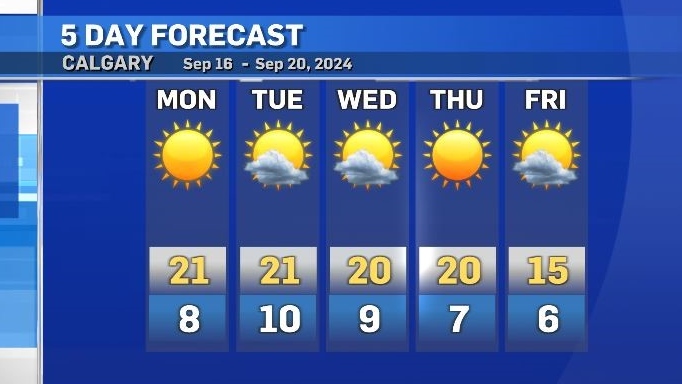
In Calgary, the daytime high will reach 21 C on Monday with highs in the low 20s for much of southern Alberta.
There will be very little cloud cover and only a light wind throughout the day and overnight, and (especially) in rural communities frost is possible overnight.
Nocturnal cloud cover can serve to trap heat in during cooler overnight periods, and wind can help to mix the air in the lowest levels of the atmosphere (closest to the surface).The absence of both in transitional seasons like Spring and Fall can result in frost and/or early morning fog.
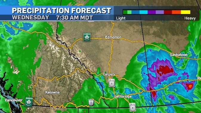
Rain is expected in the southeast corner of Alberta later on Tuesday, with the potential for some unusually intense storms for this time of year.

This precipitation is linked to a low pressure system with a southerly flow, so it is possible Calgary could be impacted by rain as well – although the heaviest accumulations should remain in southeastern Alberta, in central Saskatchewan, and along the foothills west of Calgary.
Daytime highs and lows will remain above seasonal for most of this week, with a cooldown starting on Thursday night.

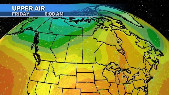
A low-riding polar jet will be enhanced by some well-positioned low pressure systems acting to draw colder air into the southern Prairies by the end of the week.

View original article here Source


